Grove Mill, Mitcham; where in 1934 many of the iron wheels from Surrey Iron Railway waggons were still visible in the tail-race, is being given the Ravensbury treatment. All but the central building is being cleared for housing.
The central building will be converted into flats.
In fact, there was already not much to see. The small row of cottages called the Fisheriesthe that were originally built to house the mill workers for the Grove Mill that stood nearby but has now disappeared. In the early 20th century they were used by the Wandle Fisheries Association, an association set up by the local Gentry to stock the river with trout.
However it is a chance to revisit this ancient industrial site. As part of the planning process an Archaeological report was commissioned from Compass Archaeology, who produced an excellent report in 2002, drawing extensively on the resources of the Museum and Merton Historical Society (mostly in the person of Eric Montague, and in the various works produced by him and Peter Harris over the years).
As the report shows, there has been a Mitcham mill since the Domesday Book, and, (as Mitcham itself lay north of the Wandle it is reasonable to assume that this was the site. , as the London Road crossed the Wandle by a ford rather than a bridge, and it is unlikely that anything requiring water power or use would be set where the water would be regularly fouled by traffic.
Real evidence emerges during the 17th century, and the Grover mill site went through copper, flour and soap manufacturing stages before ending its life as an orthopaedic shoe factory.
Crown Mill standing behind it, but destroyed by fire in the 1960's, goes through felt manufacturing, engineering, and then flour. A third mill stood on the south side of the Wandle, facing these two.
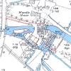
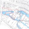
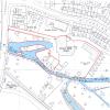
More interesting event than that, though, is the evidence shown by the 100 years of plans annexed to the report, from 1879 through to 1968, demonstrating the ways in which the River Wandle was tortured and twisted to suit the requirements of the industrial ages, with the present course out of Watermeads south of Grove Mill an invention of the last 50 years only.
The site has a special interest to the Museum, as it was here that two Surrey Iron Railway wagon wheels were dredged up from papermill cut, one of which is to be seen in the Museum, and also in the local legend that the Crown Mill site was used as factory and workshops for the benefit of the Surrey iron Railway during its brief existence.
If possible, we will be making more of the report available through the website, but this will require copyright clearance.
See figure 1; The site in relation to the 1st Edition Ordnance Survey 24 inch mile ma of 1879 (surveyed 1865-67), See figure 2; The site in relation to the 2nd Edition Ordnance Survey 24 inch map of 1895 revised 1894), See figure 3; The site in relation to the 2nd Edition Ordnance Survey 24 inch: mile map of 1935 (revised 1932), See figure 4; The site in relation to the 2nd Edition Ordnance Survey 1:1250 map of 1954 (revised 1953).
Ed, February 2004
 |
Figure 1 [74.9kb] |
 |
Figure 2 [54.3kb] |
 |
Figure 3 [59.3kb] |
 |
Figure 4 [53.9kb] |
 |
Figure 5 [58.1kb] |